
Walt and Barb had to go home, but the rest of us tried our hand at finding a virtual geocache that had been set up by some family friends. Here's the info: Yosemite Virtual Cache
If you know the Valley well enough then you don't actually need a GPS to find all the places you're supposed to go. :-)
We all had bikes so we were able to travel from location to location on our bikes rather than walking or relying on shuttle service, and that was fun.
|
| Our starting point, near the lower Yosemite Falls viewing area. Which is also the former site of a Miwok village. |
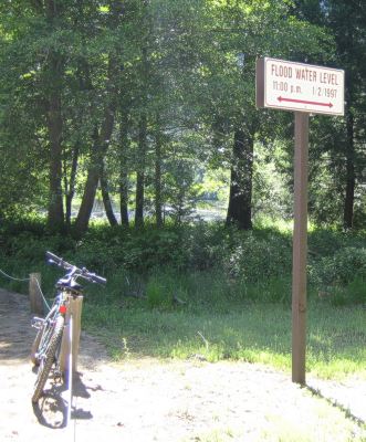 |
| The water got really, really high in the valley on 1/2/97!!! |
 |
| The Swinging Bridge...which doesn't actually swing. Though probably it did originally, before one of those pesky floods destroyed it and they had to rebuild it. |
 |
| Nice reflection of Yosemite Falls near the bridge! |
 |
| And a nice view of the falls from the meadow, also. |
 |
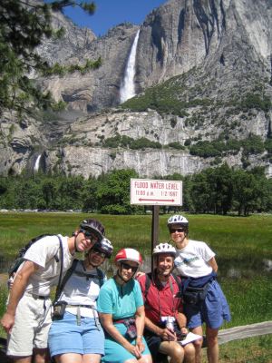
| This flood marker is the tallest one that I've seen...I can't even imagine the amount of water necessary to flood the valley that deep! |
 |
| Sia suggested an interesting variation on taking the group photo here. |
 |
| Oh look...yet *another* view of Yosemite Falls! :-) |
 |
| The final waypoint - which was very close to where we had started. |
 |
| Staircase Falls, taken while eating lunch on the deck at the Curry Village Taqueria. :-) Another of the only-in-spring waterfalls, it falls 1300 feet from Glacier Point down the cliffs near Curry Village - the stream actually runs through the cabin area. |
 |
| Taken on an afternoon bike ride at Sentinel Bridge. |
 |
| Half Dome at sunset. |